blah blah blah
Cherry Ponds
Length: 5.1 miles out-and-back with loopDifficulty (click for info): Beginner
Elevation Gain: 40 feet (+80 feet on return)
Rating (click for info): 7/10
Elevation: 1109' (Cherry) and 1099' (Little Cherry)
Driving Directions:
Trailhead and parking area are on Airport Road in Whitefield, NH (the ponds are in Jefferson). Airport Road begins on the northwest side of Rt. 115 as Hazen Road, 2.2 miles west of Rt. 115A and 4.4 miles north of Rt. 3. The large dirt parking area is 1.4 miles up Hazen/Airport Road on the right. Click here for a Google map.
About the Hike:
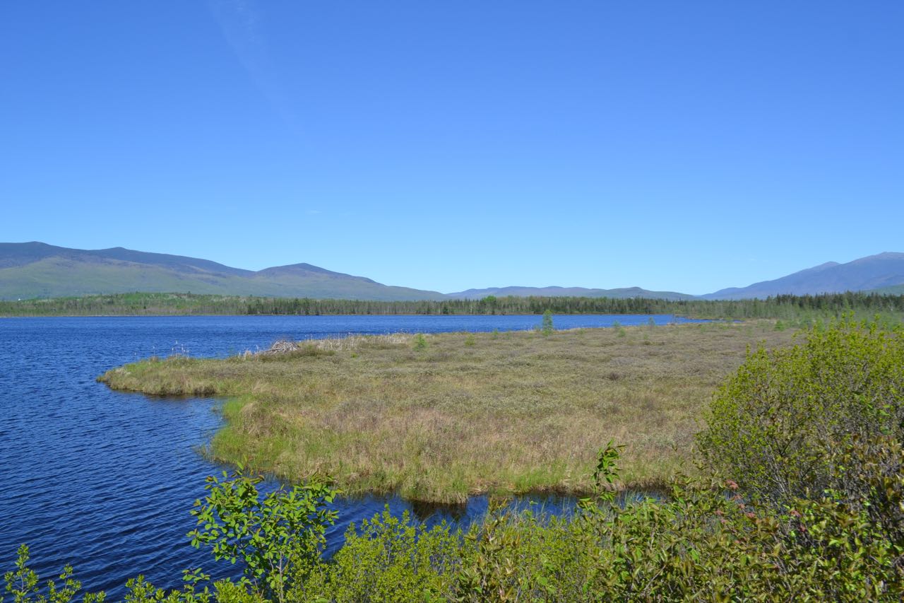
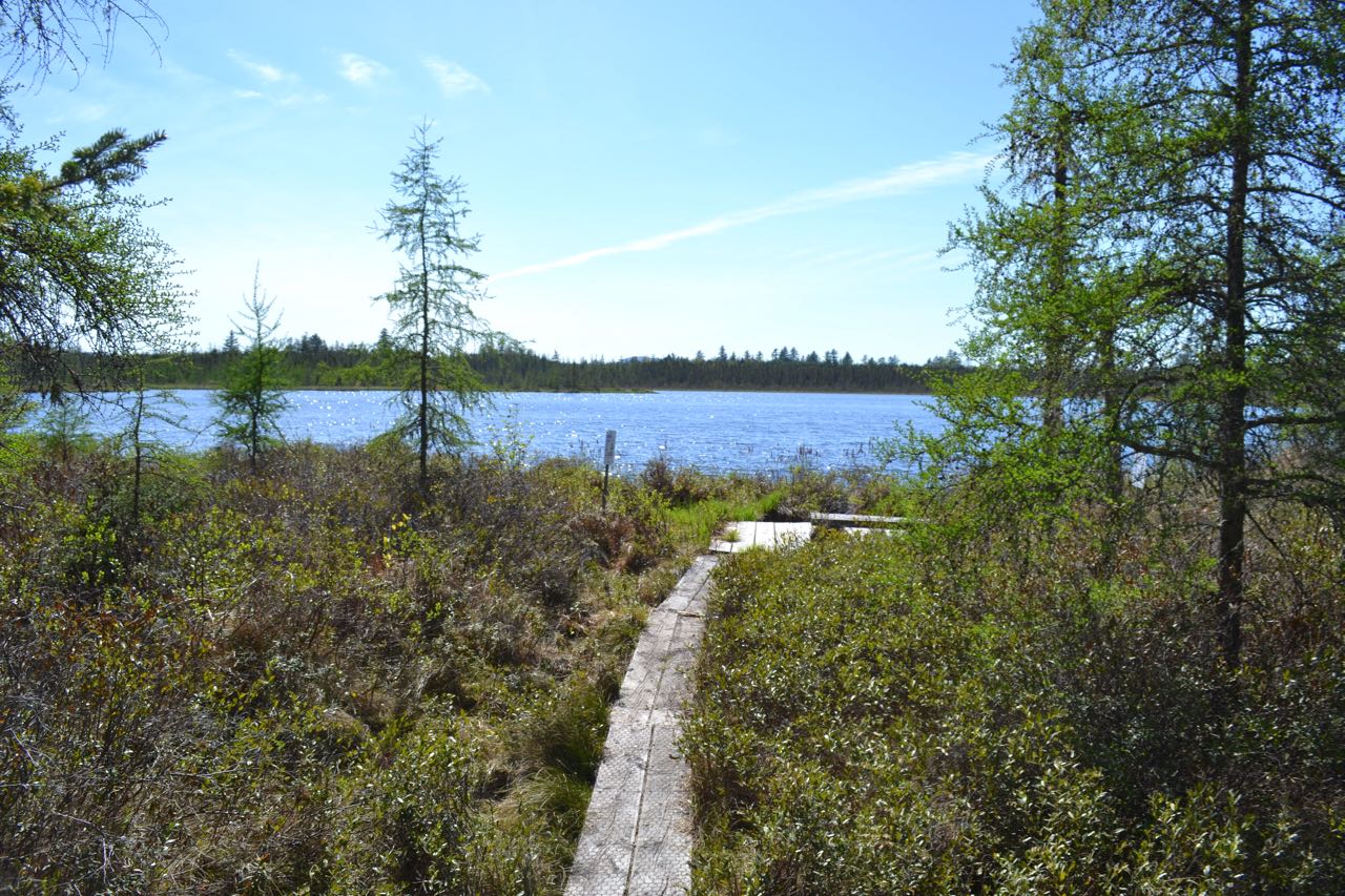
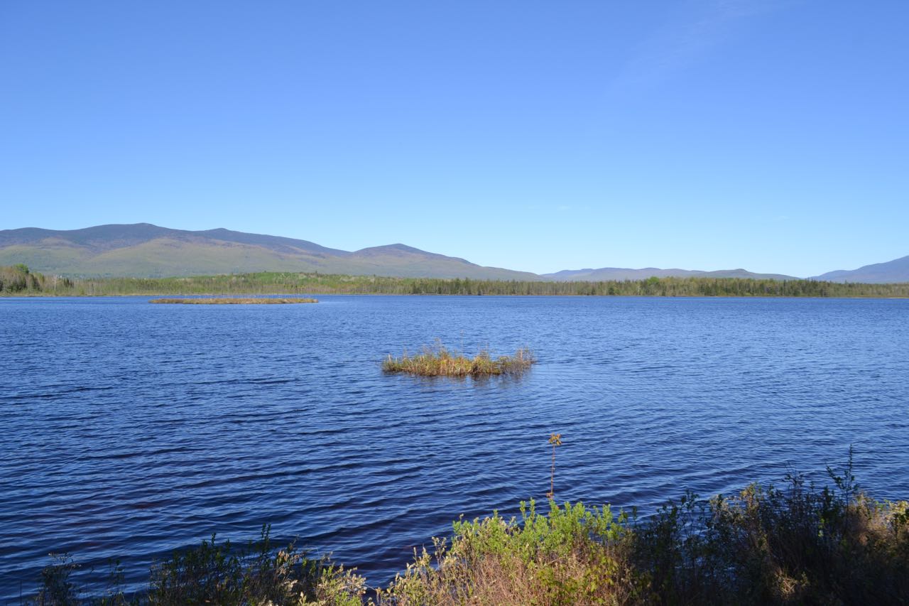
Cherry Pond is the centerpiece of the Pondicherry National Wildlife Refuge, a huge preserve stretching across a wild plateau crisscrossed by railroad and spotted with wetlands. The solitude at the ponds attracts nature lovers and bird watchers to spend hours entranced by the quiet beauty of the wetlands and the mountain vista seen over the water. The primary access to Cherry Pond is the Pondicherry Rail Trail, one of a system of multi-use trails built out of former railroad grade now called "rail trails". Like most of these trails, the 1.4-mile walk to the pond is very straight and flat. At 0.8 miles, the trail passes through a power line cut. After 1.3 miles, bear right onto a shortcut connecter to the Presidential Range Rail Trail. Across the path, step out onto a boardwalk to the observation platform on Cherry Pond. From the bushes at the outskirts of the pond, a magnificent view over the tranquil water is obtained. The Pliny Range is the main feature of interest in the distance and adds an aura of grandeur to the pond; the majestic Presidential Range appears off to the right. Linger here for a while, but remember to divide your time between the two ponds you will visit; while Cherry Pond is clearly the more scenic pond, Little Cherry will likely serve you the entire time with a people-free nature experience.
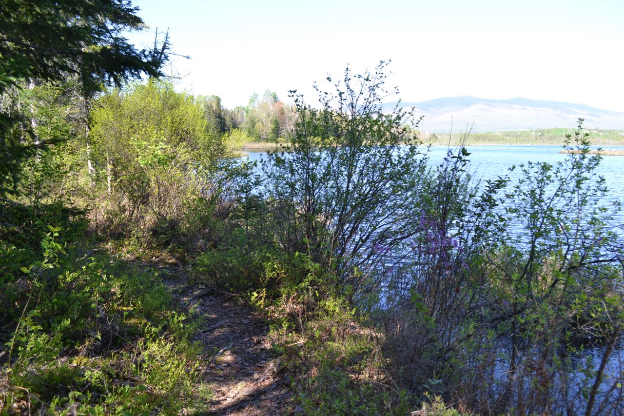
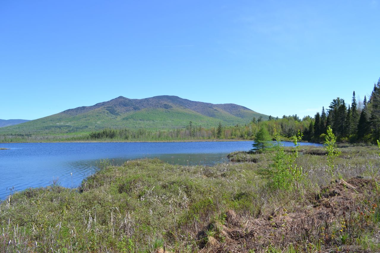
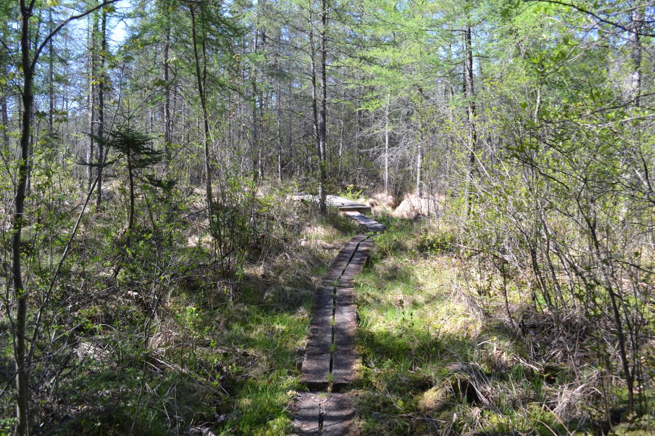
Walk back out the boardwalk and turn right and walk back out to Pondicherry Rail Trail at a place known as Waumbek Junction. Turn right and continue a few more steps to join an active railroad to cross the Johns River, a marshy waterway flowing from Cherry Pond. Use caution and watch for trains here and in an upcoming section where there is little space to the side of the tracks. Across the bridge, Shore Path drops into the woods on the right to make a short loop along the shore of the pond offering more views, wildflowers, and a chance to avoid some of the railroad tracks. When this short diversion rejoins the railroad, you must walk along a lengthy section through a marsh on the west shore of Cherry Pond (offering a view of Cherry Mountain) before Rampart Path, another chance to see the scenery and escape the railroad tracks, diverges to the right to make a short loop, passing good views over the pond and passing Colonel Whipple Trail (The Cohos Trail). When it rejoins the railroad, cross the tracks and set off into the woods on Little Cherry Pond Trail, which meanders through the wild and dark forest to the loop junction after 0.2 miles. The junction is marked only by an arrow sign indicating that you should turn left, but you can complete the loop in either direction. Both forks are about 0.4 miles long and take a wandering course through the mossy woods. At the end, they meet in a boggy area crossed by boardwalks, where a short spur leads out to the edge of Little Cherry Pond. Little Cherry is smaller than its relative and lacks the impressive mountains towering over the water, but the sense of peace and solitude found here is worth the extra distance.
Printable directions page